Greenspace Hackathon
At the 2018 Greenspace Hackathon, I joined Adam Betuel of the Atlanta Audubon Society and 10 other volunteers to raise awareness about bird/building collisions in the Atlanta metro area.
The Design Challenge
Each year, up to a billion birds collide with buildings in the United States. Glass windows and other reflective surfaces can be invisible to birds during the day and bright lights disorient migrating species at night. Since scientists began monitoring bird collisions in the fall of 2014, over 900 birds from 89 different species have been collected and studied in Atlanta.
We had a weekend to raise awareness about bird mortality, so we narrowed in on two pain points:
- Lack of knowledge and engagement among the general public about bird mortality
- User error such as species misidentification in bird collision reporting
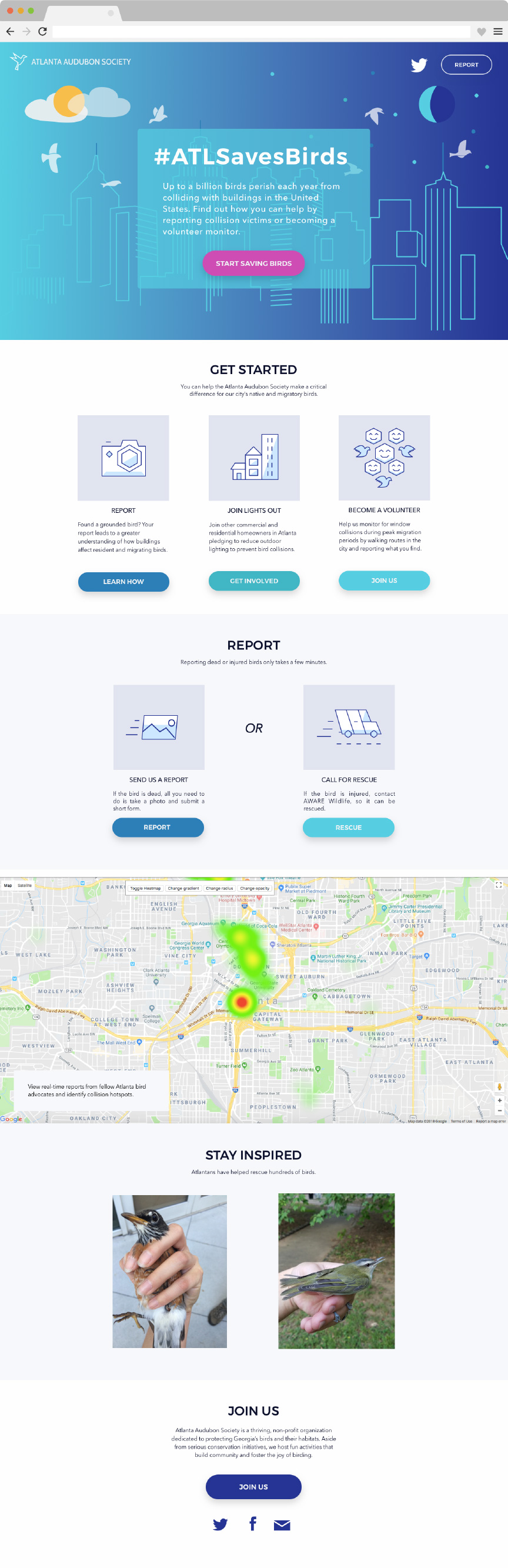
That lead us to design a site that increased awareness and engagement about bird mortality and provided real-time data on bird collisions via an interactive map.
Prototype
We used the Google Maps Visualization Library and D-bird Collision Data to create a heat map to identify hot-spots for collisions and a point map for more detailed location and species information.
In our call to action, we focused on easy, actionable ways to help monitor and reduce bird collisions. The REPORT action includes quick explanation of bird collision monitoring, the JOIN US action prompts the user to sign a pledge to reduce light pollution, and the GET INVOLVED action links the user to opportunities to join the monitoring project as a volunteer. I helped code up the prototype and created the hero image of the Atlanta skyline.